| Northwest Territory |
|
From Rivers to Roads: A Short History |
|
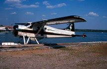
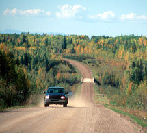
Most of today’s commerce in the north is conducted by aircraft, road vehicles and locomotives. But not all of it. Tons of freight is still shipped by river every summer. It’s a lingering reminder that roads are relative newcomers in Canada’s north. Today’s motorists drive roads that cling to the same rivers traveled by the early inhabitants and explorers. The highways are tied to a history that spans an extensive period of time – from the echoes of the distant past to the promise of the future.
|
|
5. Gold Fever |
| The First Peoples: |
|
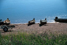
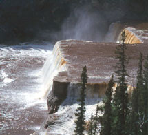
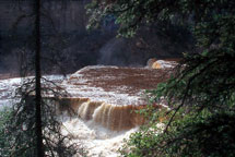
Mountain Dene, South Slavey, Beaver, Chipewyan and Dogrib, Carrier and Sekani are some of the Dene that are encountered on the route today. Cree people, too, now reside along parts of the Deh Cho Travel Connection. For centuries, birch bark and spruce canoes silently plied the northern waters and mountain peoples rode the wild rivers in moose hide boats. |
|
The first European trader recorded in the Athabasca and, possibly the Slave Lake areas was Hudson's Bay Company employee William Stewart, in 1715. The Northwest Company got the jump on the Hudson's Bay Company in 1778, when Peter Pond built the first trading post in the Athabasca River delta. Trading posts, both Hudson's Bay and Northwest Company, continued to be built along the Peace River in Alberta in the late 1700s and early 1800s. 1805 and 1806 saw the Northwest Company build the first trading posts within the present boundaries of British Columbia. For well over a century after Sir Alexander Mackenzie traveled up this river in the 1780s, the 800 km of navigable water from Hudson’s Hope in BC to the Vermilion Chutes east of Fort Vermilion, Alberta served as the main "highway" for northeastern BC and northwestern Alberta. The union of the two rival trading companies took place in 1821 under the name of Hudson’s Bay Company and, one by one, posts were built farther and farther north into what is now known as the Northwest Territories. |
|
|
The voyageurs were the backbone of the fur trade. They were usually French-Canadian or Metis, and they led a colorful but hard life. They paddled the canoes and rowed the larger boats that carried men and supplies over the rivers and lakes far to the north and west. They lugged the packs over portages. They supported the fur traders and taught them how to live off the land. They built the trading posts and helped run them. Many Cree-French Metis voyageurs entered the north with the fur trade. And many settled and grew with the north country. | |
|
|
The 19th century was a time of rapid change. Roman Catholic and Anglican missions were established in the mid-1800s as far north as Fort Simpson, NWT. Gold was discovered in the Peace River in 1861. By the 1880s, the railway had reached Calgary, and a wagon road pushed north from Edmonton to Athabasca Landing. Steam-powered sternwheelers, fuelled by wood, replaced the York boats. Northwest Mounted Police began patrols out of Fort Saskatchewan – by dog team – in 1897. |
|
|
|
In 1898, an armada of canoes, punts and rowboats, containing 885 people, set out on the Athabasca River, bound for the Klondike gold fields. Their intended route to the Yukon was a torturous one, traversing the Athabasca, Slave and Mackenzie Rivers, and crossing lakes and mountains. Others struck with Gold Fever went west to Dawson Creek, BC, poised on the edge of the Klondike gold rush trail, and launched their treacherous journey from there. Some of these adventurers made it, but many stayed behind. |
|
|
|
In the Peace River country, settlers began taking up homesteads in ever increasing numbers. In 1908, research began at Fort Vermilion’s agricultural experimental farm. Paddlewheelers continued to ply the northern waters, followed by gasoline-powered boats and then by tractors, which came into the north by 1919– just in time for oil development at Norman Wells, NWT in the 1920s. A new era in transportation and communications dawned. Aircraft were seen in northern skies, and the Royal Canadian Corps of Signals opened wireless stations, starting in 1924. Trains came as far north as Waterways, AB (now Fort McMurray). Uranium and gold were discovered on Great Bear and Great Slave Lakes in the Dirty Thirties, and trappers, prospectors, and bush pilots flocked north. Food, tools, equipment, tents, men and supplies, all had to move through the country – by rail to Waterways, boat to Fitzgerald, over the portage to Fort Smith, down the Slave River by boat to Great Slave Lake, then on to Hay River, Fort Simpson and Great Bear Lake. |
| Three highways make up the "Deh Cho Travel Connection" – the Mackenzie, the Liard and the Alaska – and each had unique reasons for its development. | ||
|
|
Northern transportation was still very difficult and unreliable. When waters were low on the rivers, supplies could not be delivered. When low water on the Athabasca River prevented supplies from getting to the Yellowknife gold fields in the summer of 1938, something had to be done. An aerial survey was flown in January 1939 to find a route for a road. By mid-February the survey crew and bush-cutters were at work. A tractor-train loaded with supplies left Grimshaw on March 9th, and arrived at Hay River April 3, 1939 on a new winter road. World War II meant surprising developments for this corner of the world, so far from the heat of the conflict. In 1942, 1,500 troops launched north from Peace River. They were to build a pipeline to transport Norman Wells oil to the Yukon and on to Alaska, as fuel for the army. The U.S. Army improved the winter road north from Grimshaw to Hay River, and airstrips were built throughout the region. After the war, in 1948, this road became the all-weather Mackenzie Highway. Gradual improvements extended the highway systems to most communities around Great Slave Lake, terminating at Fort Simpson at the confluence of the Mackenzie and Liard Rivers. |
|
|
|
The Liard Highway is named for the Liard River Valley through which it runs for most of its length. In French, Liard means “black poplar”, and this wilderness highway is a corridor through a forest of white and black spruce, trembling aspen and poplar. Progress inevitably led to a need for a route from BC into the Northwest Territories. The Liard Highway would connect still-isolated Aboriginal communities to the world around them, and open a new access to the territory. The final link in the Deh Cho Travel Connection was opened in 1983. |
|
|
|
After the bombing of Pearl Harbor, isolated Alaska suddenly became a strategic location. This led to the development in 1942 of the BC end of the Deh Cho Travel Connection – the Alaska Highway. Americans and Canadians (including a large number of Aboriginal people through whose homelands the road would run) built the 2400-km road, linking northeastern BC with the Yukon and Alaska. At the peak of construction, 11,500 troops, 7,500 civilians, and 11,000 pieces of machinery worked on this road. In 1949, after having been improved to a year-round all-weather road, the Alaska Highway officially re-opened to full-time civilian traffic. |
|